

Busy Week of Severe Weather Ahead
It's yet another busy one, and this one looks more tornadic than last...

1. Monday and Tuesday
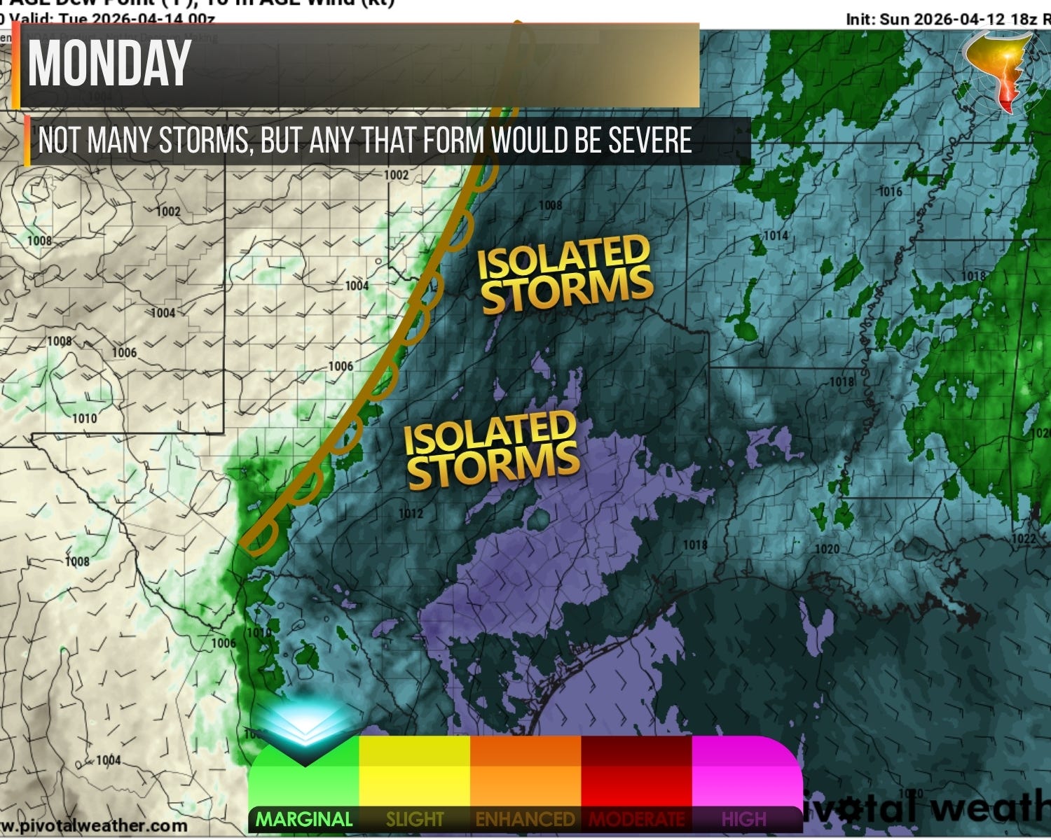
Monday is the deep breath before the week gets loud. A few storms could fire, and anything that does will probably be severe, but the setup is stuck awkwardly between active systems to the west and east. That middle ground is usually where storms go to not exist. We’ll be watching, but Monday isn’t the story.
Tuesday is.
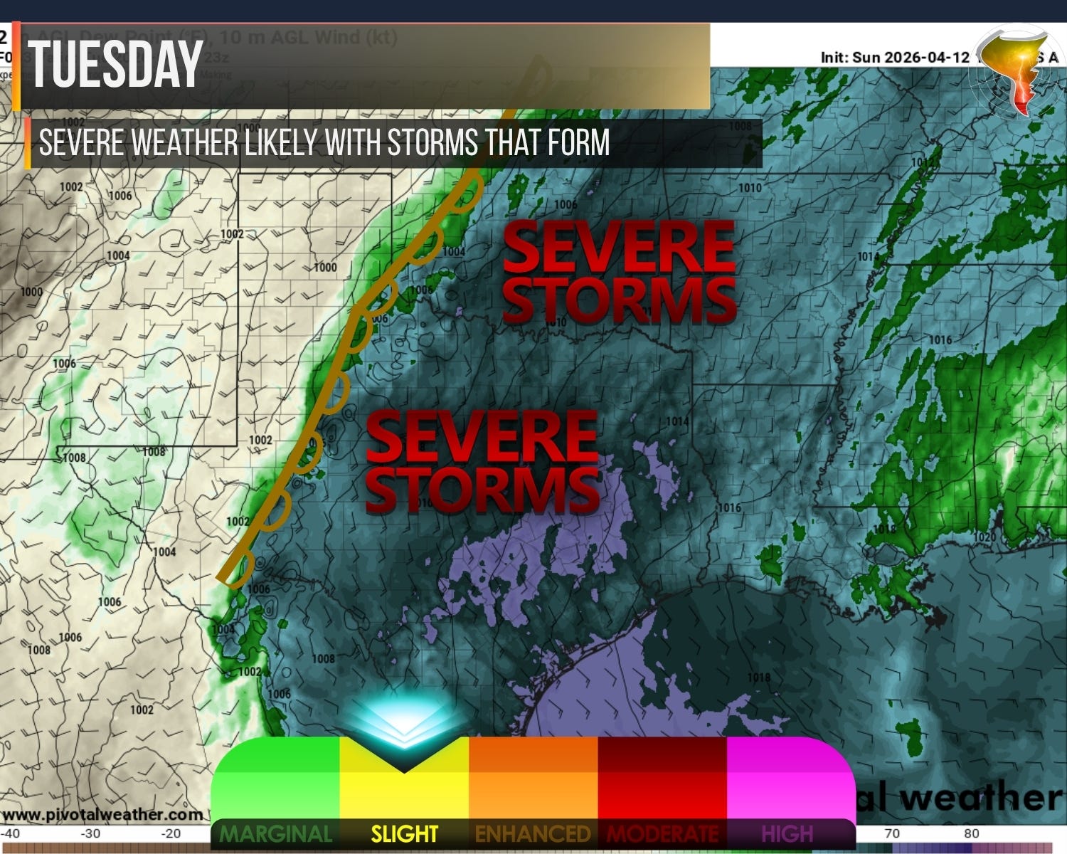
A wave ejects in the early to mid-afternoon, dragging plentiful shear behind it, and it’s walking into an atmosphere that’s ready to explode. We’re talking extreme instability in some areas, dewpoints near 70, and very little capping to slow things down. The fuel is there. The trigger is there.
So what’s the concern? Storm mode. Shear doesn’t start off strong, with 0-3km storm-relative helicity below 100 initially, though it increases into the evening. With lower cloud bases and 0-6km shear above 35 knots, my bet is we see a mixed bag of HP supercells and more linear segments. That means a lot of storms producing large hail and damaging winds with an elevated-to-low tornado threat. It’s a big day. It’s just not a clean day.
2. Wednesday and Thursday
Wednesday shares a lot of DNA with Tuesday but turns the shear dial up. A dryline sharpens over the south-central Plains with plenty of instability and stronger environmental wind shear, 0-6km values near and above 50 knots as storms form. Helicity starts unimpressive but climbs substantially by the evening, with 0-1km SRH values over 100 m²/s² becoming common. That’s an environment that can support supercells and tornadoes.
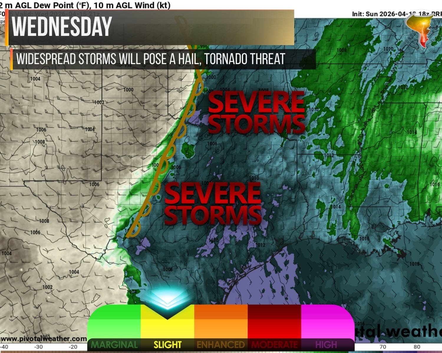
The enemy for storm chasing is the same as Tuesday: storm mode. Wonky wind profiles early on could push storms into clusters or lines before the shear really gets cooking. Still, Wednesday is shaping up to be another busy severe weather day, potentially the more dangerous of the two.
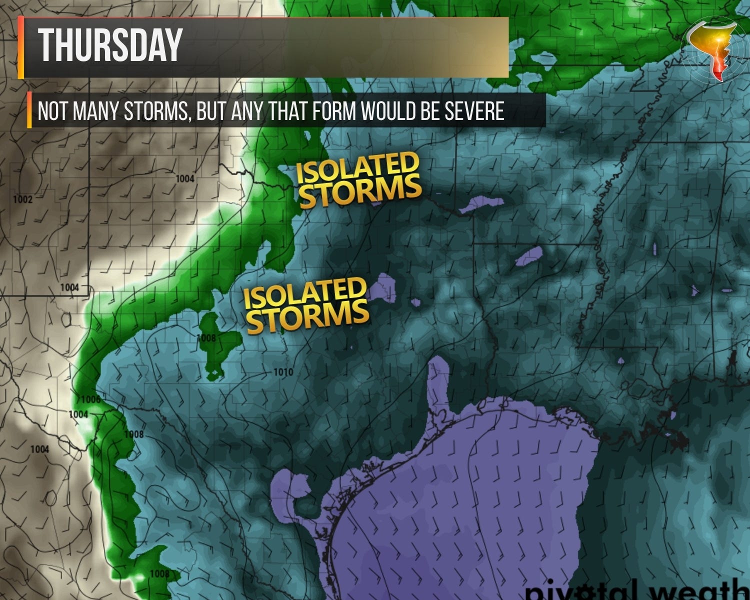
Thursday is the palette cleanser. We’re back in transition between systems. The dryline won’t be sharp, moisture will be retreating westward most of the day, and convergence along the gradient will be pretty contained. My guess? Sparse storms, late in the day, further south in the I-20 corridor. Not my favorite area to chase personally, and the environment overall just isn’t giving much. Think of Thursday as the week catching its breath.
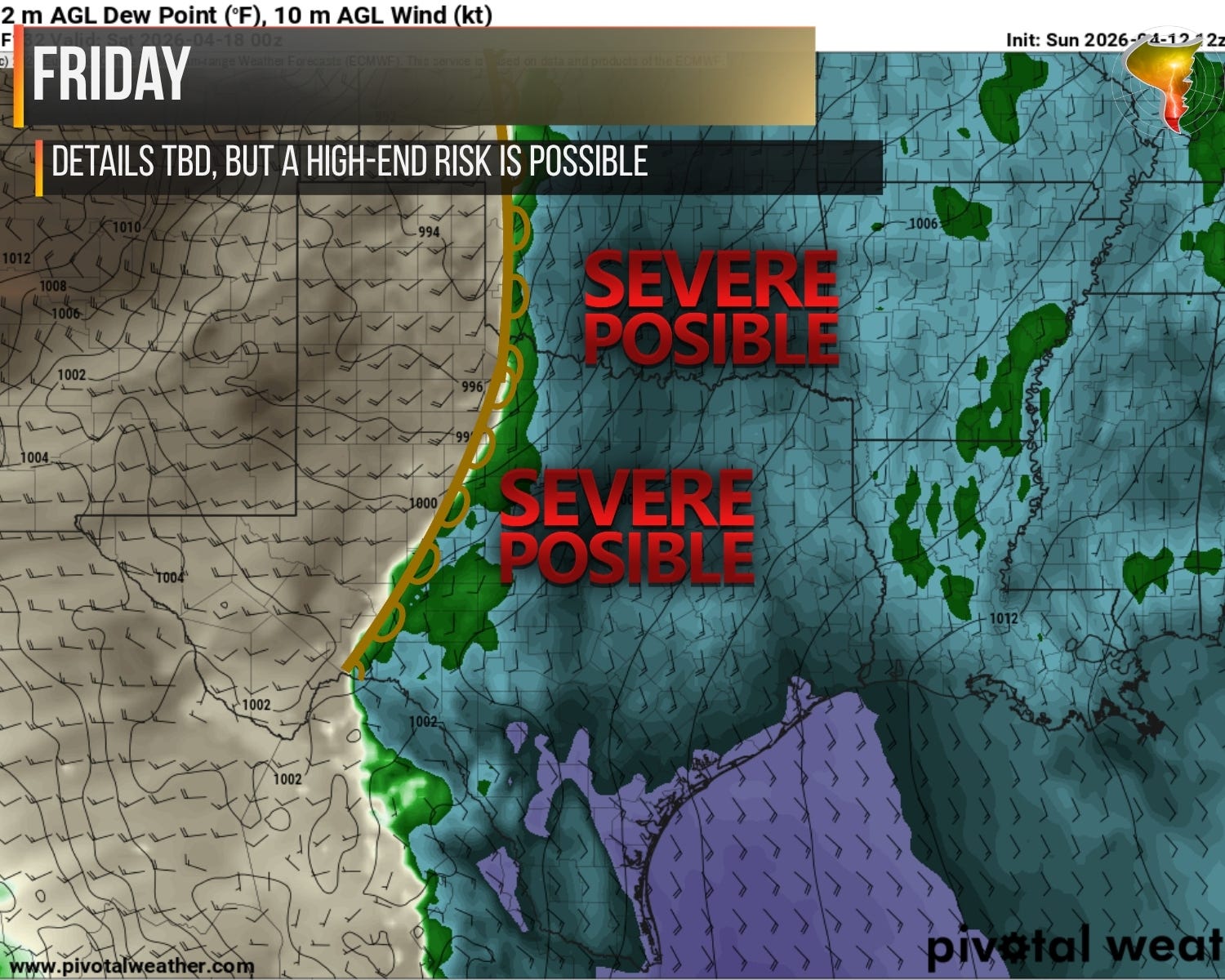
3. Friday
Then comes Friday. And I need you to pay attention to this one.
Both the GFS and Euro are showing a strong system emerging onto the Plains by Friday afternoon. Sharp dryline. Strong 850mb winds. Backed surface flow. If you know what those ingredients mean together, you already feel the hair on your arms standing up. This is a tornado setup.
How high-end? Potentially very. But there’s a catch, and it’s an important one. The wave timing may not cooperate and that has made many a ‘favorable-looking day’ at this range turn to nothing by the day of. Neither the Euro nor the GFS is producing much precipitation along the dryline across Oklahoma or Texas, with the action favoring Kansas instead. That’s the kind of detail that can be the difference between a historic day and a highly localized one. We’ll need to see what the convection-allowing models do with this before making any big calls.
Here’s the bottom line: there’s a real chance Friday generates some significant risk headlines if storms look likely up and down the dryline. Keep it in the back of your mind as we work through the earlier days this week. I’ll have more on Friday across our social media, and YouTube members will get a dedicated forecast video as we get closer.
4. Our First Twister of the Year
It wasn’t much, but here is the biggest ‘highlight’ of my first day out yesterday near Las Vegas, NM, where we watched a supercell quickly ramp up and produce a tornado in rapid succession before it dissipated and we had a multicell slop-fest the rest of the day.
Las Vegas is a tornado hotbed that has been historically undercounted, and it’s not hard to understand why. The terrain east of town has few roads and even fewer people. Unless you’re a storm chaser purposefully looking for a tornado out here, nobody’s reporting one. Unlike the DCVZ, most of the tornadoes that form in this area are supercellular in nature, which makes the undercount even more frustrating because these aren’t random spin-ups. They’re real storms doing real things with no one watching.
I’ve now seen a tornado in this area every year for the last four years running. And given how early in the calendar this one occurred, I wouldn’t be surprised if I add another before the year is out.