🤔🤨 Blue Skies or Storms Tomorrow?
There is a very low chance of a storm on the dryline from Kansas to Texas tomorrow.
I’m writing this newsletter because I think it is always good practice to talk about when drylines set up but don’t fire robust storms. Tomorrow is one of those days (in all likelihood). If a storm were to fire in Kansas/Oklahoma/North Texas it would likely be a pretty tiny storm but might post a hail threat. Let’s dive in quickly.
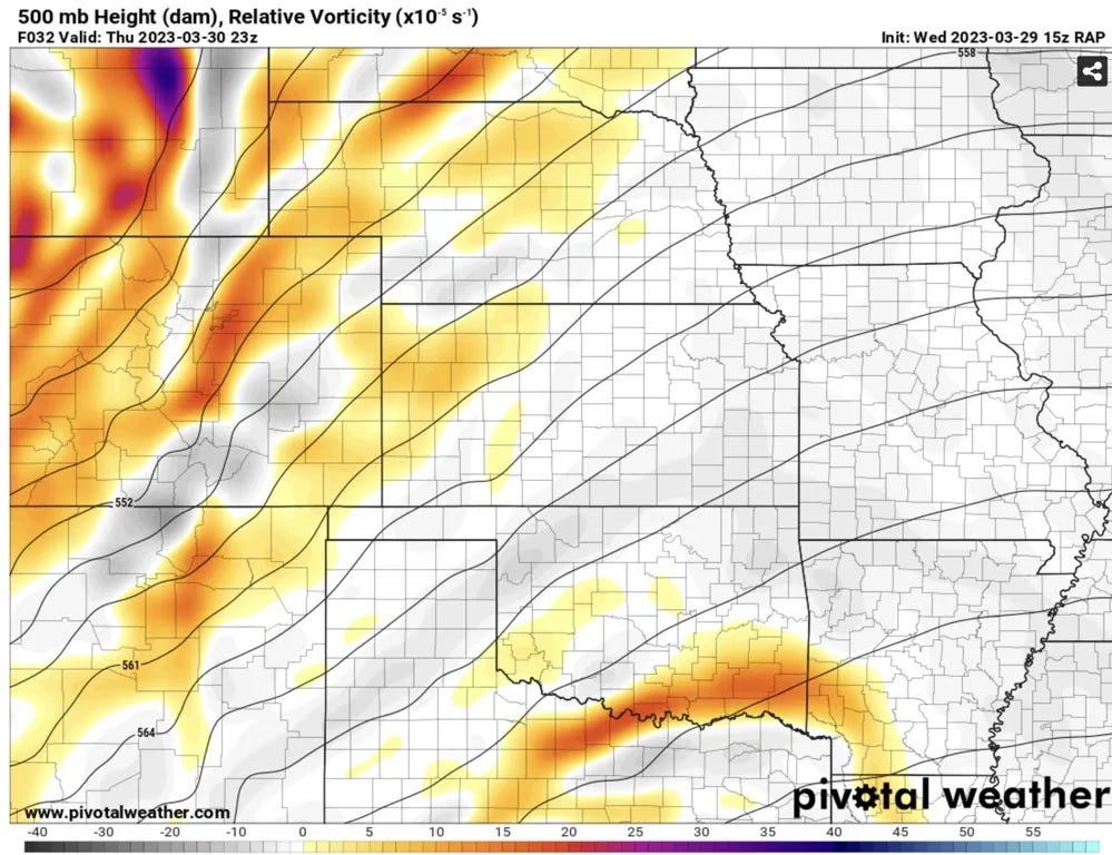
The first thing I notice is that there looks to be a bit of a weak wave that comes over the dryline earlier in the afternoon (when moisture is still quite low and a cap quite strong). This is the wave likely responsible for the showers/storms in Eastern OK and NE Texas tomorrow on models.
Unfortunately for storm chasers, this wave is leaving a pretty solid bit of sinking air in the mid-levels in its wake along much of the dryline. Sometimes these can be hard to predict or accurately get a sense of, even at this range — but this is probably one of the culprits behind a completely dry QPF signal along the entire dryline on most models.
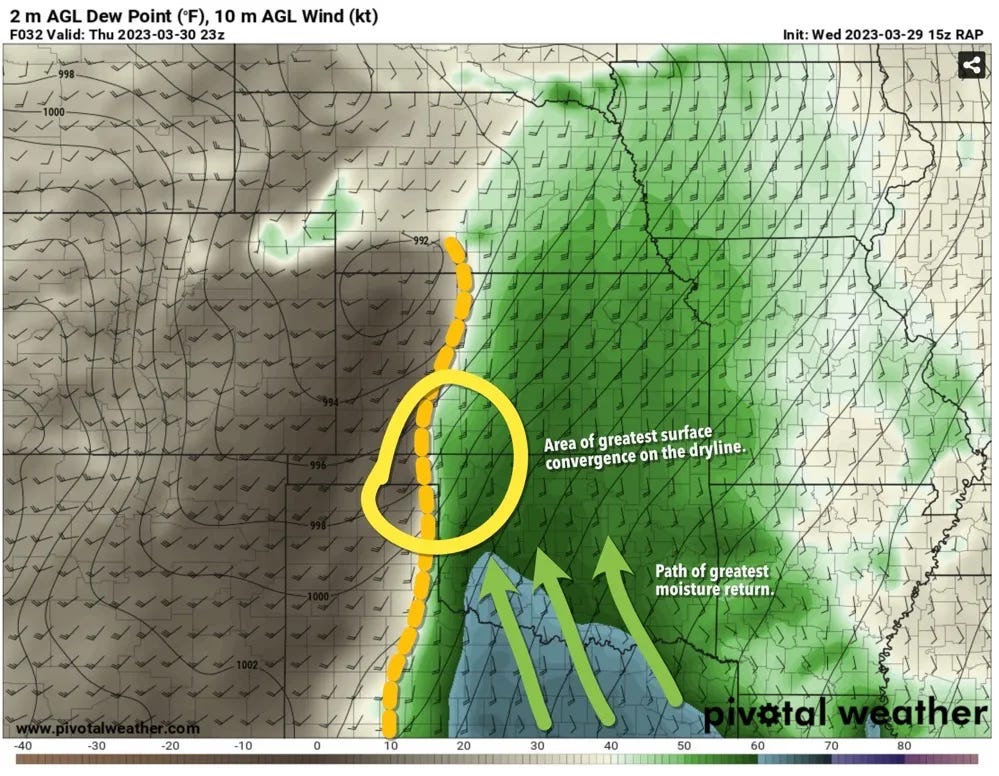
At the surface, the dryline will sharpen up by quite a bit from Southwest Kansas, the Eastern Texas Panhandle, and Western North Texas. The greatest area of surface convergence on most models looks to be in the yellow circle, which is also an area that is farther away from the effects of a rogue early day wave.
The moisture quality along the dryline is generally characterized by low to mid 50 dewpoints. A general protip for dryline is it is good to assess the air where storms might be forming to gauge if they’re actually going to form!
That seems obvious but you know.
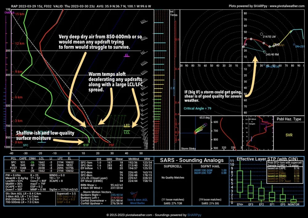
For the sounding I’m pullling what I think is the best case scenario sounding which is from the RAP. The forecast high for this area in West-Central OK is actually in the low-70s which makes this entire sounding a truly most-favorable for storms scenario.
On most models, the moisture is pretty shallow on the dryline, the RAP actually does the best job of mixing down the moisture and heating up temps tomorrow (if you want storms). Still, at peak heating you have a pretty large LCL/LFC spread which you’d need to brute force air through. Thanks to the upper storm system being well west of the area there won’t be much help from above that separation to get parcels to the LFC. The temps from 850-600mb or so are also pretty warm. This is a more advanced topic, but you can have 0 CINH and still end up with 0 storms because there are more things that need to be right to get storms along the dryline.
The dry air in that same layer would also likely cause any updrafts to entrain a lot of dry air which would be a large source of struggle for an updraft to get going. This is the “updraft looks good but there’s a hole in it suddenly” type of dryline.
The Bottom Line
I think the odds of a sustained storm are very low tomorrow. What I expect is that there will be a fair but of cumlus along the dryline thanks to some decent surface convergence and in a most optimistic scenario perhaps one manages to form for a quick bit of time. But the storm would be tiny (think thin LPs) with a short life as the air immediately east of the dryline is quite prohibitve for storms to sustain themselves without any upper support.


