

Another Messy Day of Storms On Tap
Copy and Paste Threat From Yesterday Really...

1)Groundhog Day for Storms
I’ll be honest. My biggest debate this morning wasn’t the target area. It was whether I should just copy and paste yesterday’s forecast, add “but a little further east,” and hit publish.
Instead, let me put some actual effort into this.
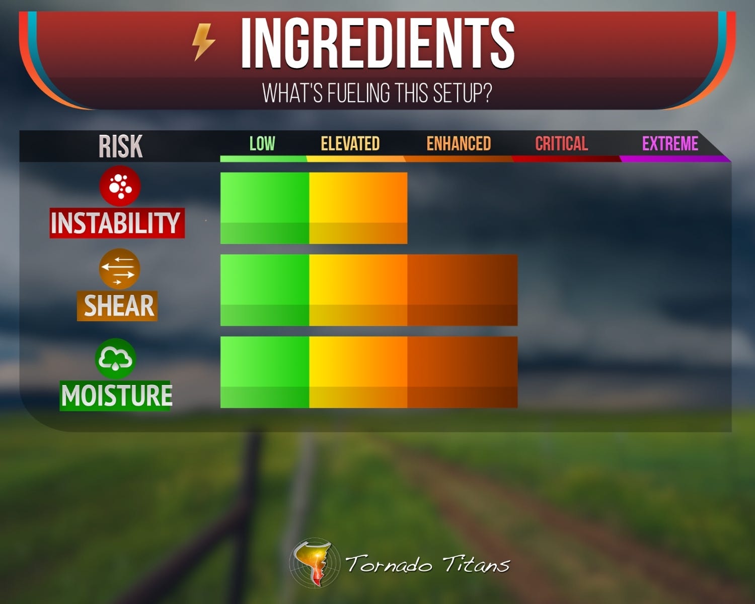
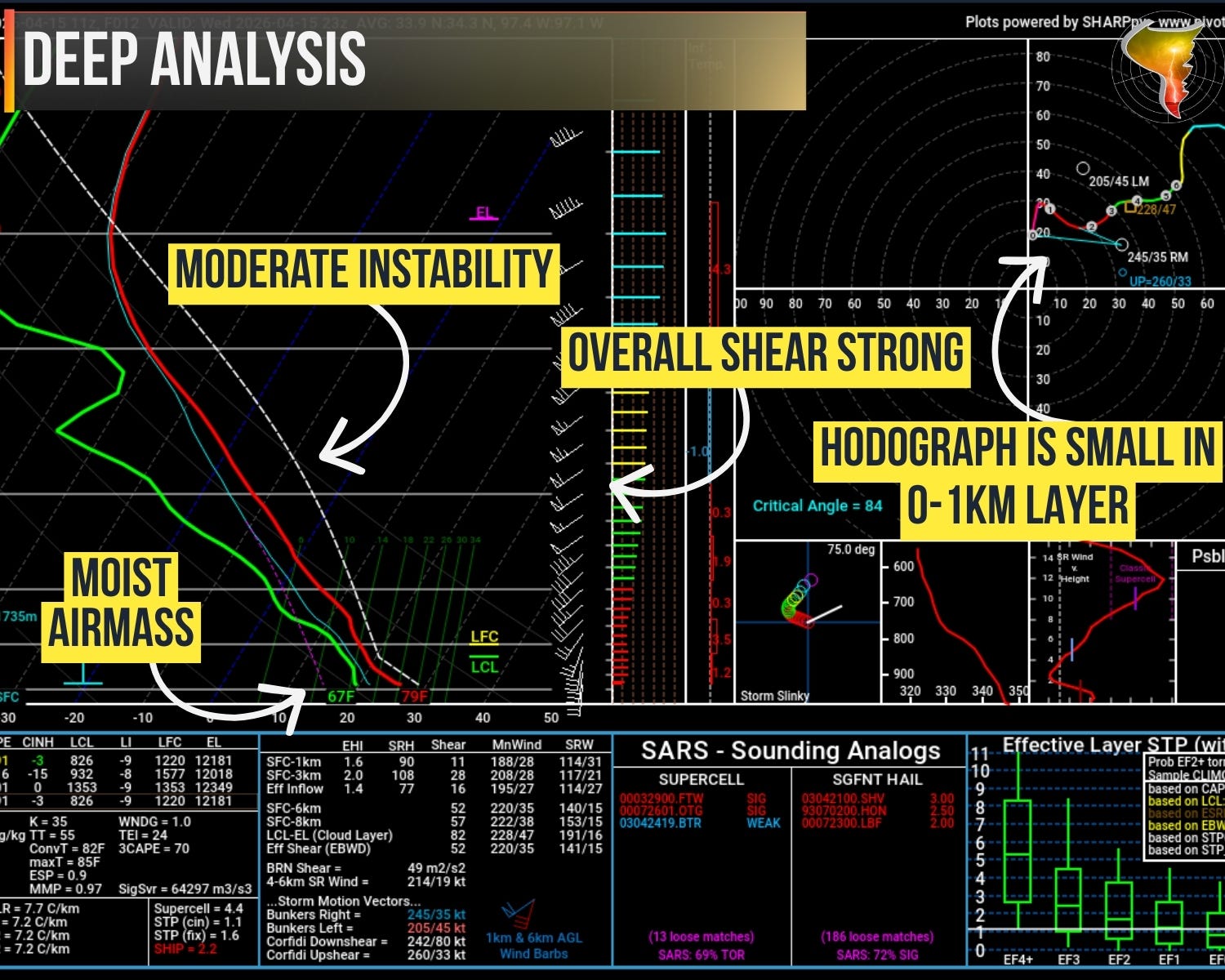
Morning soundings confirmed what we already suspected: steep lapse rates aloft, 7.5 to 8 degrees per kilometer in the 700-500mb layer, sitting on top of a very moist return-flow airmass. That’s an angry atmosphere, and it’s going to go off.
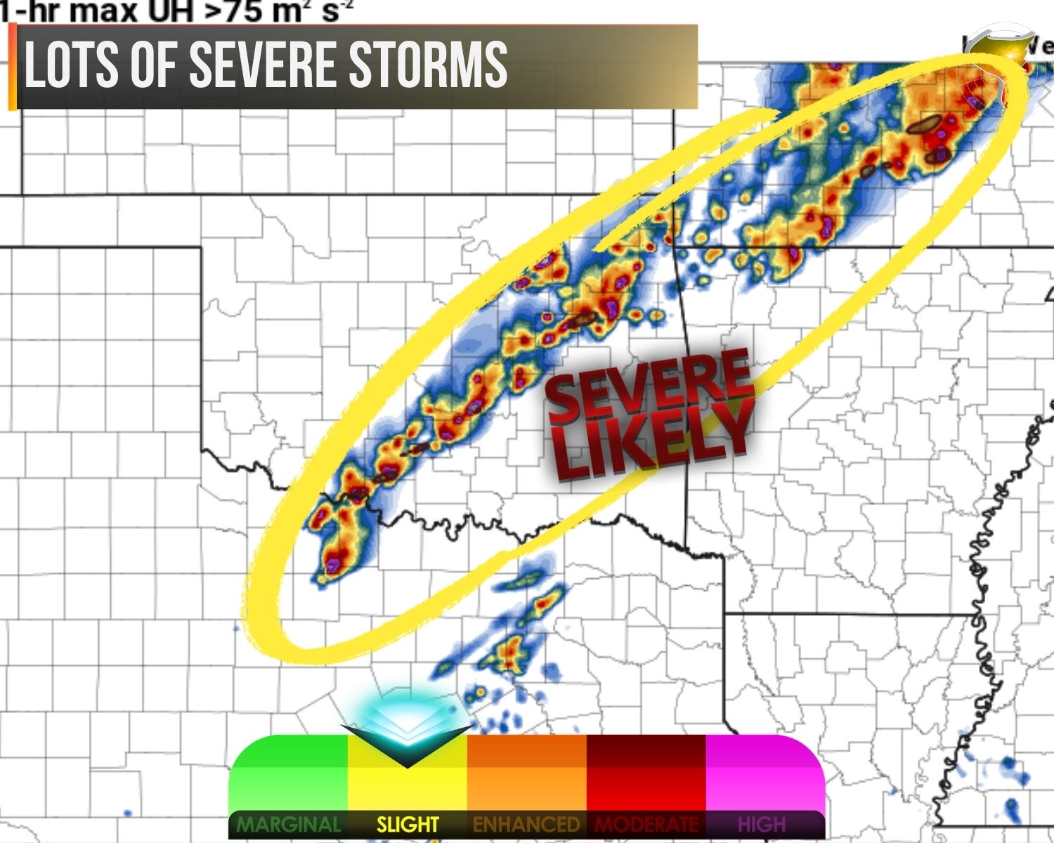
Round one starts early. Storms will develop near the dryline by mid-afternoon and go supercellular out of the gate. The stronger updrafts will be capable of large to very large hail initially, with all hazards coming into play as storms mature. This is the window where individual cells are most impressive and most dangerous.
Round two fires in the afternoon as additional storms join the party. Here’s where the forecast gets familiar: those new storms will favor clustering and upscale growth, likely merging into bands and linear segments by evening. The hodographs are partly to blame. Forecast soundings show somewhat limited low-level wind profiles with a veer-back-veer signature, which is the atmosphere’s way of nudging storms toward messy mode rather than keeping them discrete.
The tornado question is the same one it’s been all week: storm mode. The threat is there and it’s elevated, not zero. Residual outflow from overnight convection pushing into the Ozarks could enhance low-level shear later today, which would be a boost. But whether we see tornadoes largely depends on whether storms can maintain supercell structure before the inevitable march toward linear chaos.
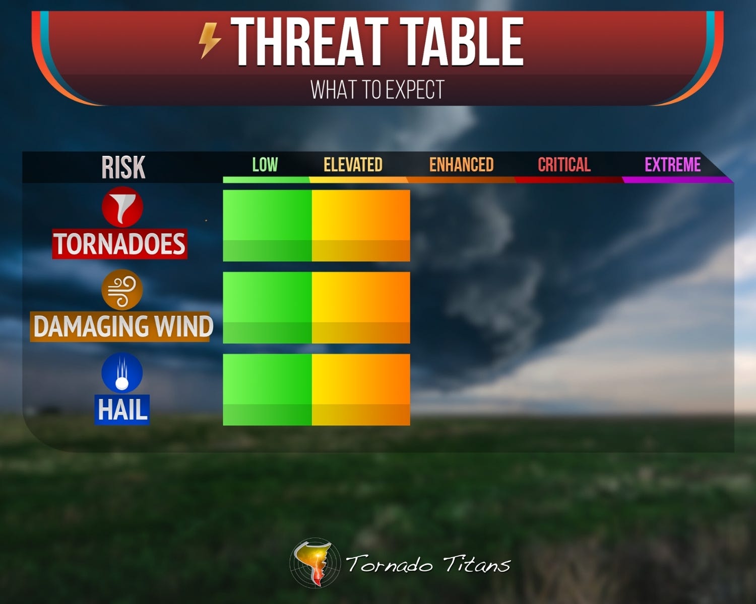
The sure bets remain the same. Large hail with early supercells, damaging winds as things organize, and a long afternoon-into-evening event that demands attention if you’re in the path.
If yesterday’s forecast sounded a lot like this, that’s because the atmosphere is running the same playbook with a slight geographic shift. Sometimes the sky isn’t that creative either.