Active Weather Returns
The dryline re-establishes in the west, but is there enough juice for severe weather?
I’m going to need everyone (including myself) to calm down for a second because the West Coast troughing is BACK!
Usually, this is a strong signal that severe weather is on its way back into the forecast, but a combination of factors will likely keep the threat on the lower end for now.
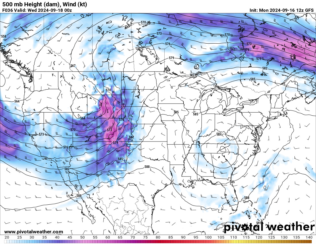
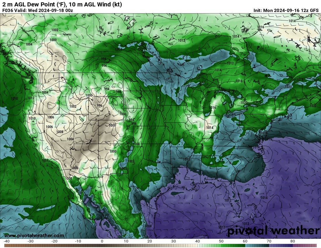
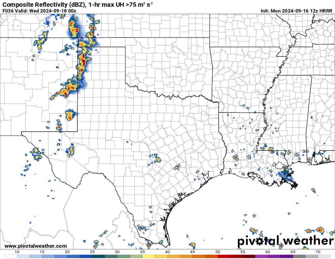
Evolution Through the Week
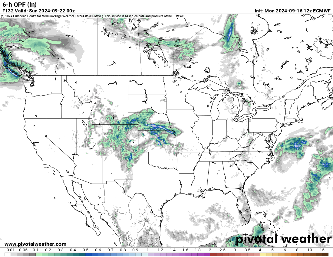
The Central and Southern Plains will be on the periphery of some upper-level energy this week with a dryline in place. There will likely be some days with storms and severe weather chances, even low-end se, but nothing screams big-time yet.
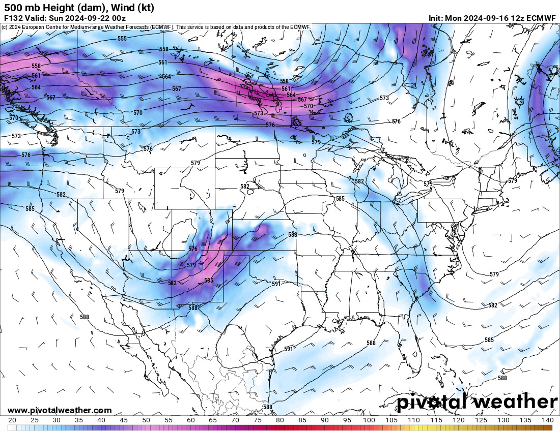
As the week goes on, another trough will dig in across the southwest U.S. — this one will have a real shot at bringing some more high-impact weather by next weekend.
Pattern Beyond
We talked about the troughing for late September for quite some time, and it’s now here. Beyond this period, there’s a signal for something towards the end of September on the GEFS, with the pattern being a bit less reasonable for severe weather into the first parts of October. On the Euro, it’s pretty bullish on a prominent ridge setting in after Saturday’s trough, bringing summerlike warmth into October for much of the U.S.
In fact, if there is one strong signal for October, it is for a very warm month overall. This may lead to subpar fall colors with later timing for some areas. If there’s a true big-time severe weather event with tornadoes on the Plains coming this fall, it’s more likely than not that you are looking for a period after October 15 for it.
On Another Note…
We’re making a few major changes with this space and all our other spaces. Look for new format(s) and changes in the coming weeks. We’re not going anywhere, but we are evolving. I hope you like what we’re doing with the place!


The best!!!
Thanks for the report!