

Active Storm Track to Resume This Week
The gradient between lots of precip and a little precip will be sharp…

This week’s weather pattern is best described as a lot of noise, a lot of stuff falling from the sky, but a storm chaser snoozlefest.
I talked to Sam, the 2024 storm chase rookie of the year and the 55th most famous golden retriever in the country, about this upcoming pattern and he simply took a nap. So I think it is safe to say that while the weather won’t be calm, it won’t be that interesting for storm chasing golden retrievers either.
Storm 1 (Tue-Wed)
The first storm system will emerge out of the Southwest on Tuesday into Wednesday with thunderstorms to the south and snow to the north. A strong cold front will also dive south, with some of the coldest air of the winter expected. This is dependent somewhat on the snowpack that emerges to the north, but lows in the teens as far south as the Red River are possible.
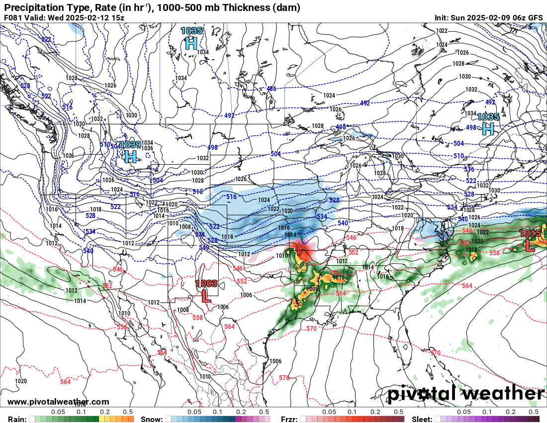
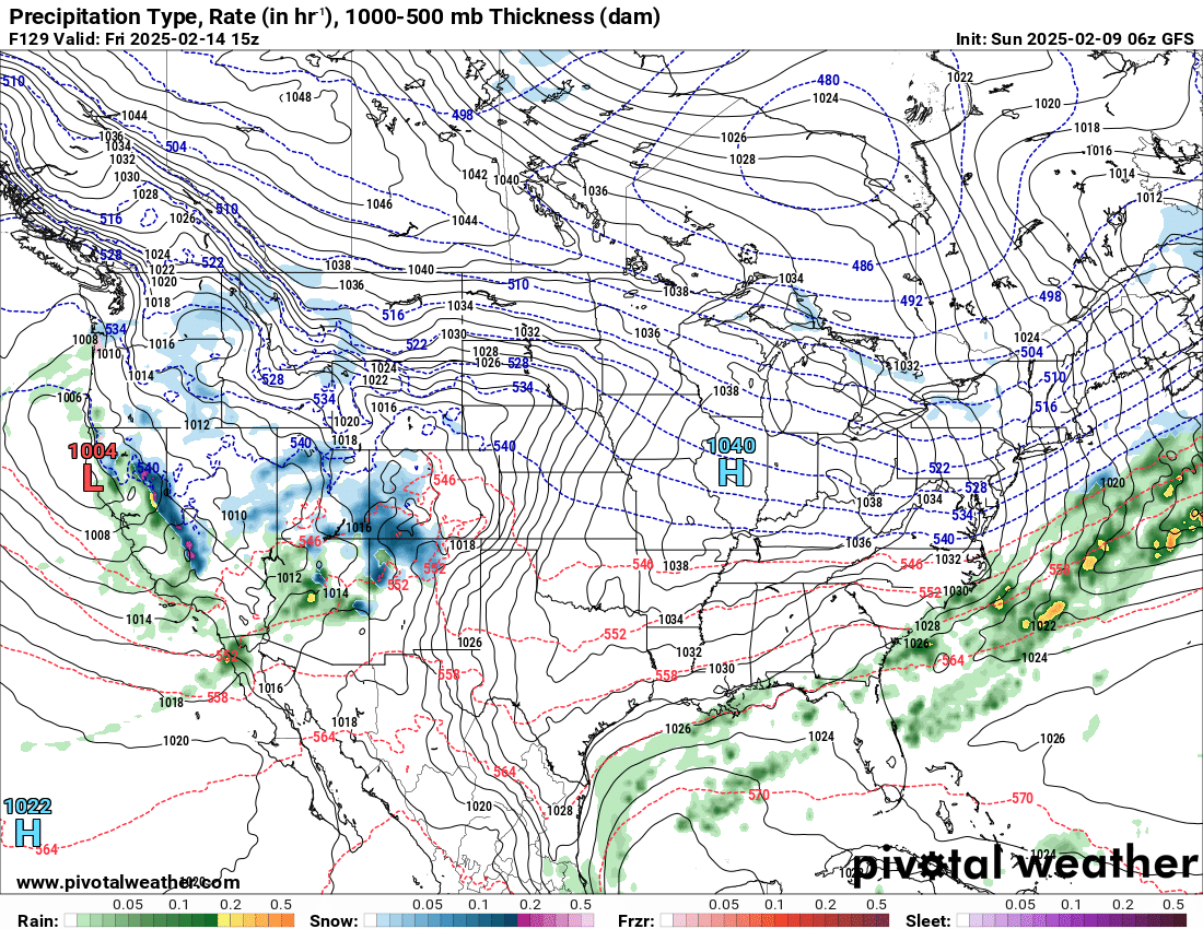
This is one model’s interpretation of the Wednesday morning precipitation situation. A broad area of snow will be ongoing across the Central Plains into the Midwest, with heavy rain to the south. There will be some embedded thunderstorms but the shear/instability combo is pretty low-end, though a severe storm or two can’t be entirely ruled out.
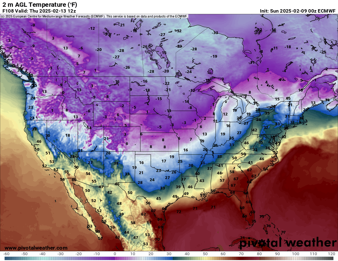
By Thursday morning, the temperature situation across the country will be very much a snapshot of winter. This is one of the coldest air masses of the season, and some areas will likely see their coldest temps of the season — but if this one doesn’t produce those it may be difficult to get lower than this the rest of the way (that’s my positive take).
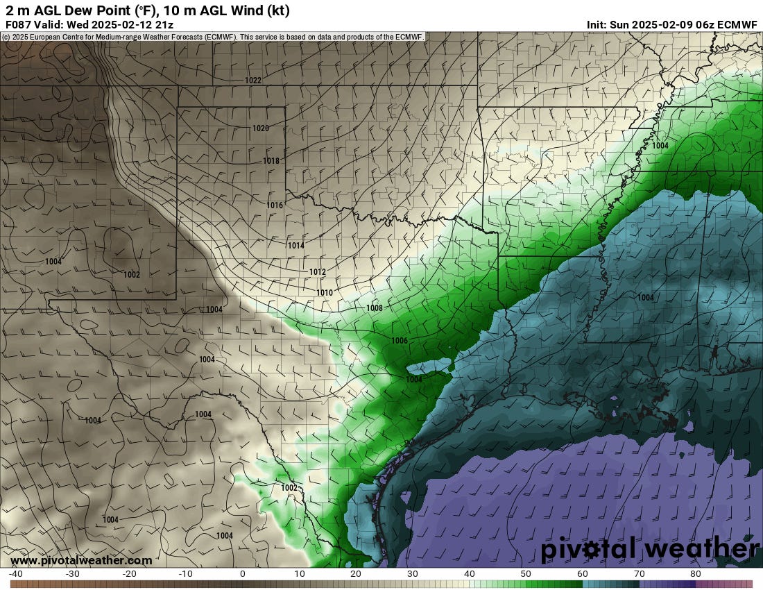
Moisture will be pretty good for the initial storm system over the southeast, with mid-upper 60s present. However, the path of the trough doesn’t exactly line up well with the surface map, as you can see the surface low is shallow and displaced to the northeast over SW TN.
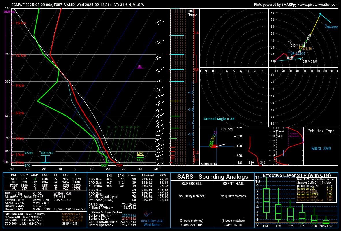
Because of that, while instability is not bad, and the overall shear (0-6km at 63kt) is good, the turning is pretty modest. This is a classic marginal severe storm environment in the southeast, with the helicity values being highly suggestive of pretty unorganized storm activity.
Storm 2 (Friday - Weekend)
The second system will deepen and draw more moisture into it with snow/rain widespread across the Southwest by this upcoming Friday.
Snow across the highlands and mountains of the Southwest will be heavy at times, with some ranges like the San Juans, Sangre De Cristos, and Chuskas getting some of their heaviest totals of the season so far.
This system will then move east onto the Plains with a familiar pattern.
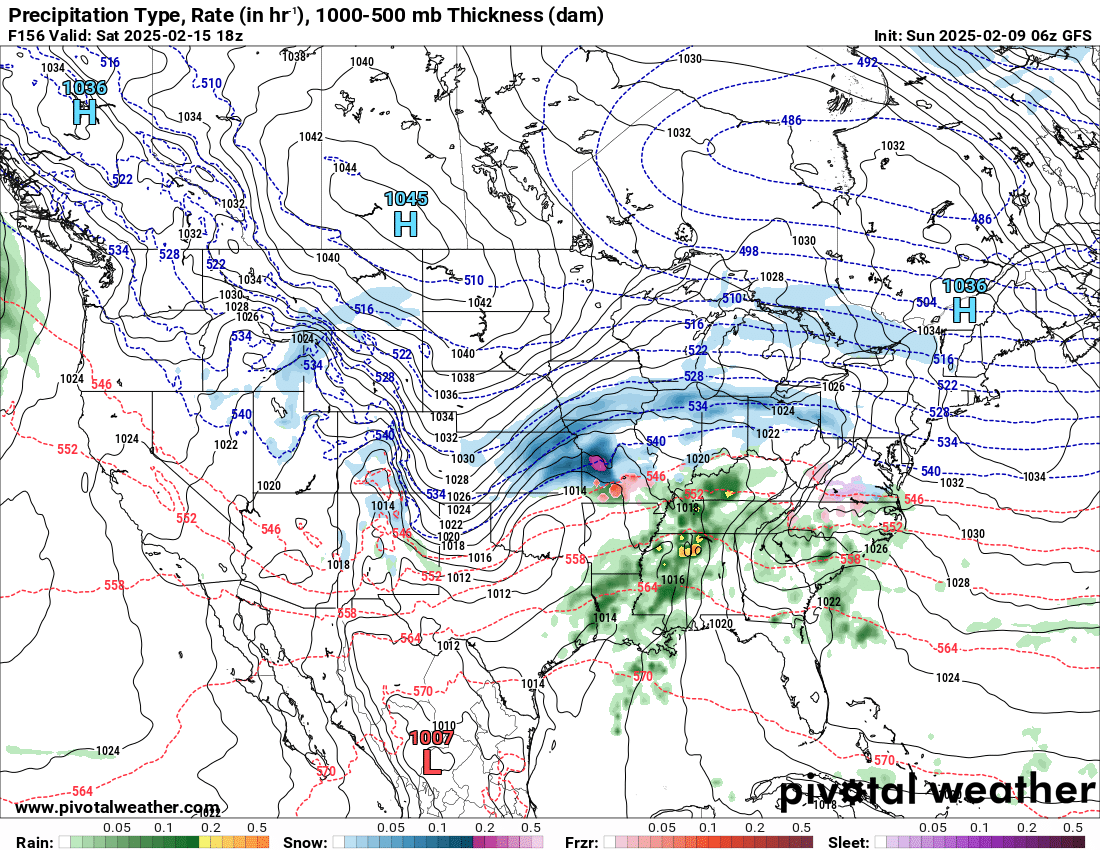
This system looks very similar to the early week system, with the precip on the Plains picking up perhaps a hair further east. Snow will likely dump across the Central/High Plains with some wraparound as far south as the Panhandles into Northern Oklahoma. Rain/storms will be widespread across the Southeast.
This second storm seems to be working with less instability than the first, so conditions should remain marginal for severe weather.
Overall Precip Outlook
It seems likely some flooding will occur across the southern U.S. from this parade of systems, with 4”+ possible across some areas in rapid succession.
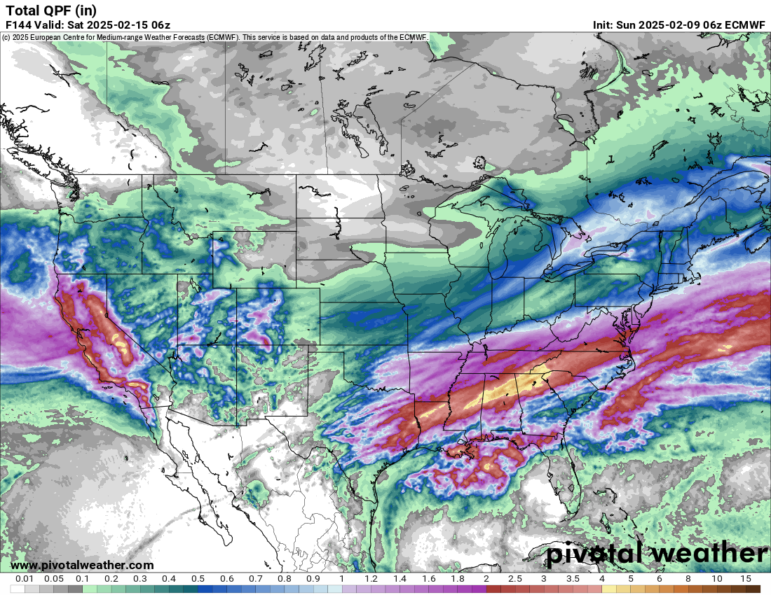
The precip line will likely be pretty sharp somewhere over Central Oklahoma down into Central/West Texas. The second system will bring some precip to the Southwest to help this map some, but I am also cautious about that second system verifying as perfectly as models suggest right now. Either way, the story continues — growing drought across W TX and SE NM will continue, which will have direct implications on the strength of the elevated mixed layer (EML) this upcoming spring.
We’ll have our full tornado season outlook early next month!
This Was the Most Surprising Tornado Chase of My Life
Sometimes the best chase days happen when you least expect them. On July 5, 2024, in Northeast New Mexico, I went out with low expectations—there was a 0% tornado risk, and I thought spotting a supercell would be a win. Instead, I got an unforgettable tornado show north of Las Vegas, NM, with multiple funnels spinning under an electrified sky. As if that wasn’t enough, the day ended with a hail barrage near Dilia, where giant hailstones slammed down around us. This chase was a masterclass in the unpredictability of severe weather, and I’m still in awe of what unfolded.