

A Weekend of Action then Pattern Shifts
We're about to see a brand new look to the season...

This weekend will see a busy storm regime to be sure, but not a ‘major league’ threat on anything, so to speak. As you read this, Saturday’s event may already be underway — with Sunday’s event basically a continuation of the storms that start tonight.
1. Saturday then Sunday
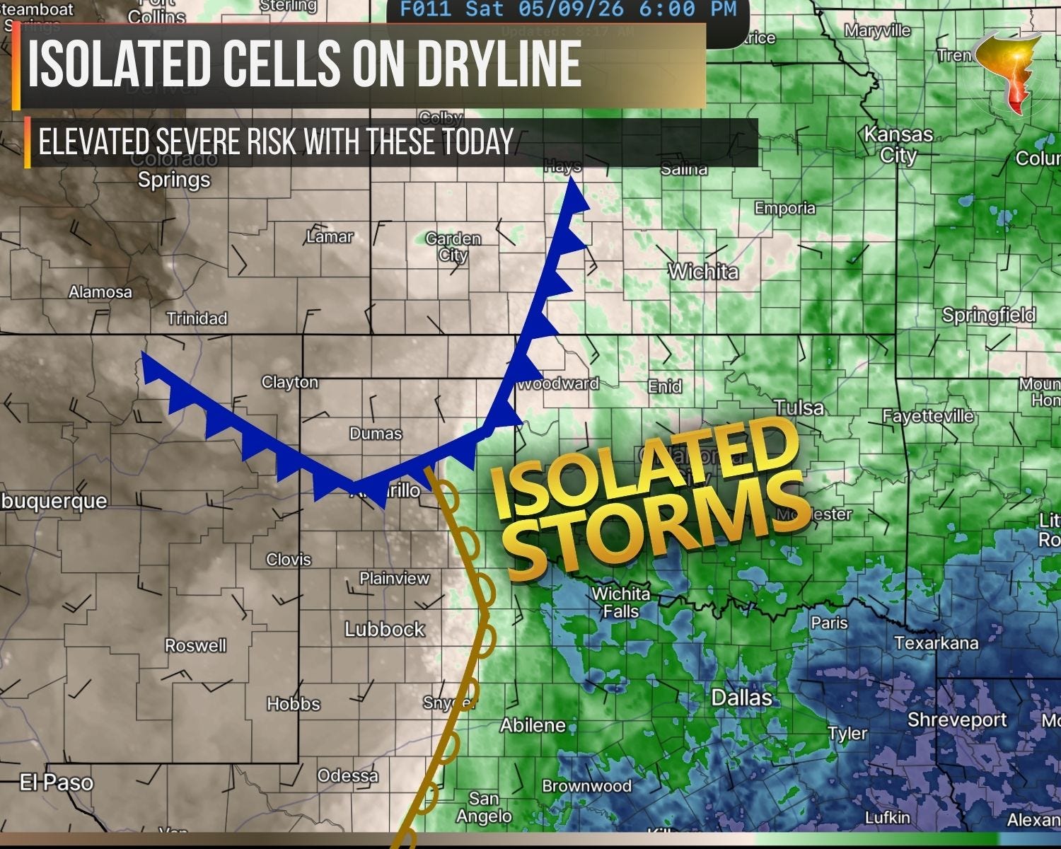
A dryline sets up today with only modest upper-level support. Convergence in the dryline zone and just enough moisture could squeeze out a few storms that move east and south. Could. The atmosphere isn’t making any promises.
The catch is a familiar one. Right off the dryline, the low-level environment is dry, which means high cloud bases early on. By the time storms push far enough east into better moisture, the cap is likely strengthening. That leaves a pretty narrow window for anything significant, and an even narrower one for a tornado. Large hail is the headliner again today, with damaging winds as a secondary threat.
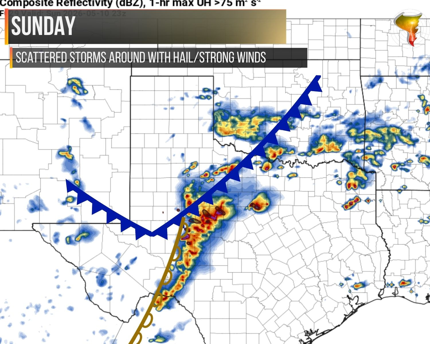
On Sunday, storms will be more numerous and geographically shunted further south. Hail and damaging winds will be the primary threats with these storms, only a very low tornado threat is expected and only if a dominant supercell can get going into the evening hours.
2. The Rest of May Looks Like June
The big story emerging for the rest of the season is how the jet stream is set to radically change and weaken about a month early, with a more summertime pattern setting up. This will mean less wind shear for storms but possibly more energy. As a storm chaser, the high CAPE/low shear days are far preferable to low CAPE/high shear days. The pattern is telling a pretty consistent story to what we’ve experienced much of the last week: tornado risks on the lower side, but not zero — with hail being the primary threat.
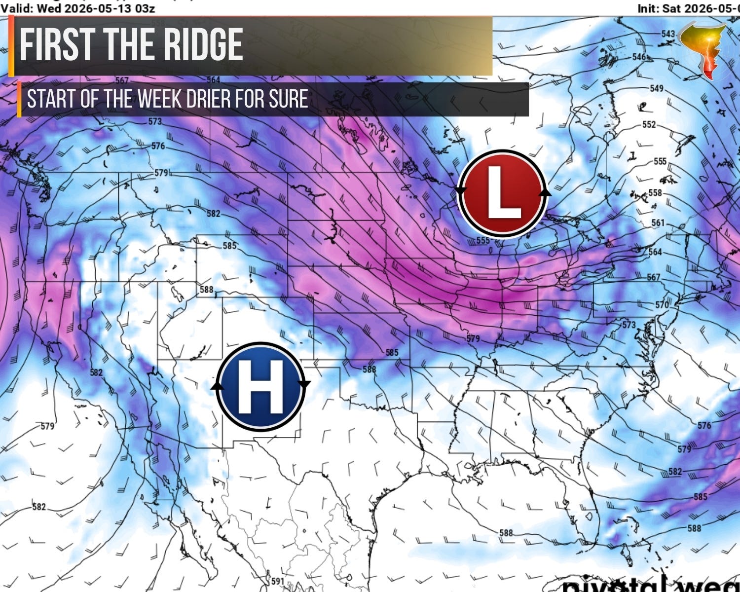
Starting off, early this week, a trough in the east and ridge in the west is the idealized “you don’t get severe weather anywhere” pattern. As moisture from the gulf stays locked up and air aloft sinks, the Plains will be rather quiet until later in the week.
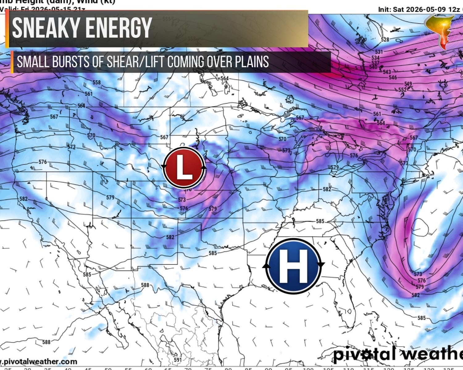
By late week/the weekend A low will shift the high just a little east, allowing for some meager energy to work its way over the Plains. Since there won’t be a lot of moisture around with this round, expect that round to look a lot like this round with just enough moisture for big severe storms and just enough shear for supercells. But that should be the extent of it.
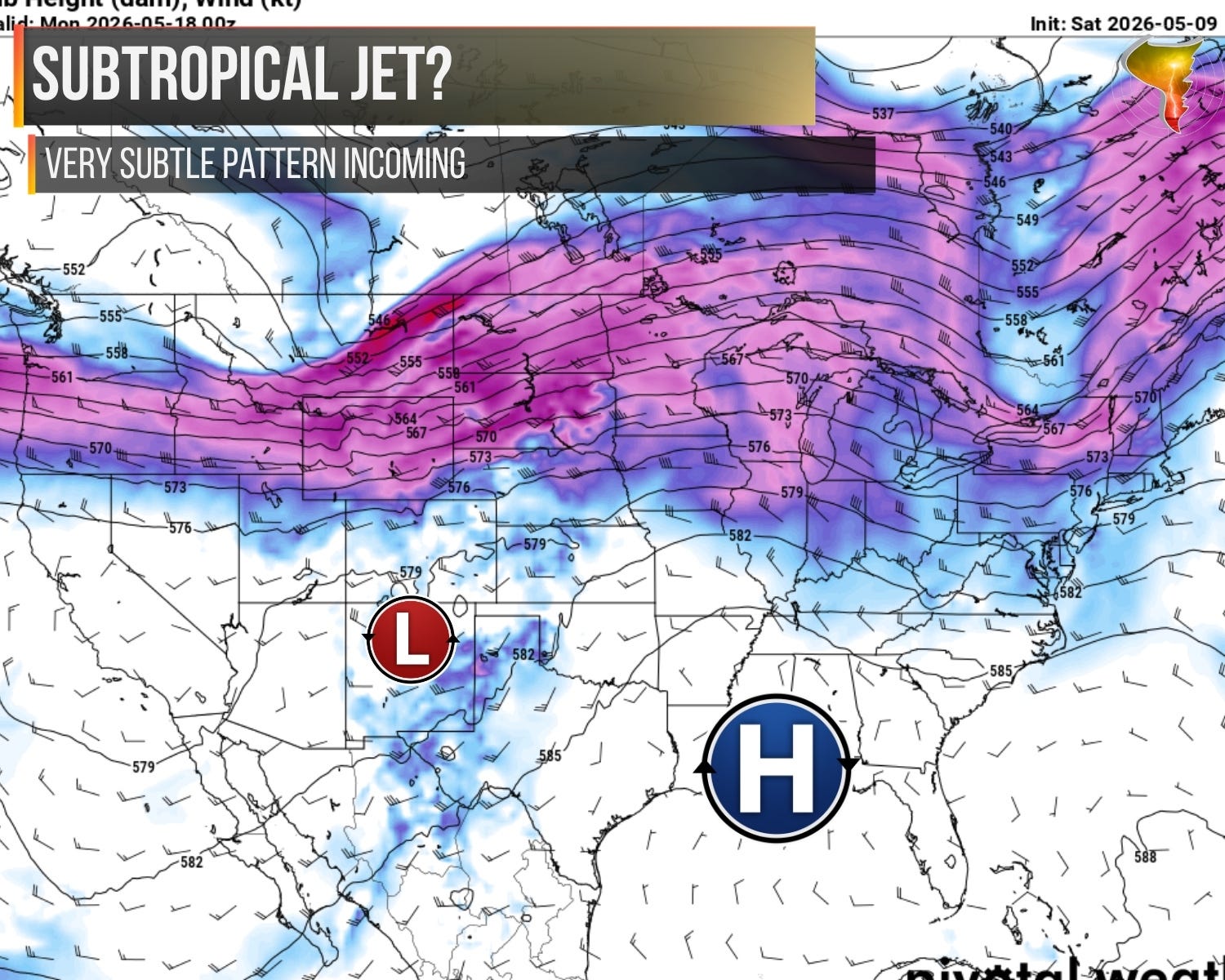
As we move into the last half of May, ridging will be dominant across the southern U.S. — the question is going to be what the jet stream can manage to do. While there will be a lot of jet energy north, the moisture will be pretty limited. This looks like a classic pattern where subtle/small shortwaves will be the drivers of storm activity, with day to day variability based on the results of the day before. Lines may lay out boundaries for new storms to form on the next day, and generally chaotic surface patterns will emerge. Eventually, we should have a closed low of some sort make its way out, the ensembles are trying to edge in that direction.
I’m not seeing a clear signal for BIG severe weather in late May, just a continued steady drumbeat which resembles this week. A few days on, a few days off. No major outbreaks, lots of mesoscale forecasting needed and gradually improving moisture through the end of the month to help make setups more volatile.