

A Mostly Quiet Week Ahead But the Change is Coming
Expect the weather to get much more unsettled by Sunday/Monday.

We’ve been in a pretty dry, pretty quiet pattern for much of the last month — but that is about to change as we move through this week and into the weekend, as a parade of storm systems moves east into the Southern/Central U.S.
Pattern Evolution
Currently, the Plains have been stuck under a ridge that has kept our temperatures relatively warm; some areas are in the 80s, particularly in the Panhandles and Eastern New Mexico. This dry northwesterly flow aloft has brought occasional fronts, which have cooled the eastern parts of the region, resulting in a significant east-to-west temperature gradient over the last week.
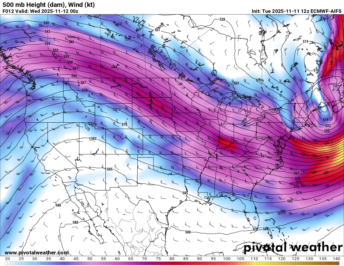
However, as we move into the next week, there’s going to be a big change in the pattern as a storm system moves ashore in the western U.S. and digs into the ridge — pushing it aside and bringing unsettled weather (finally) to the South-Central U.S. again.
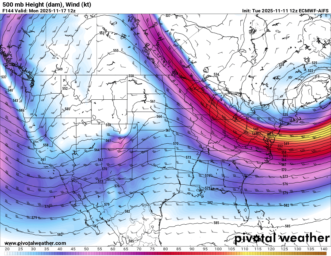
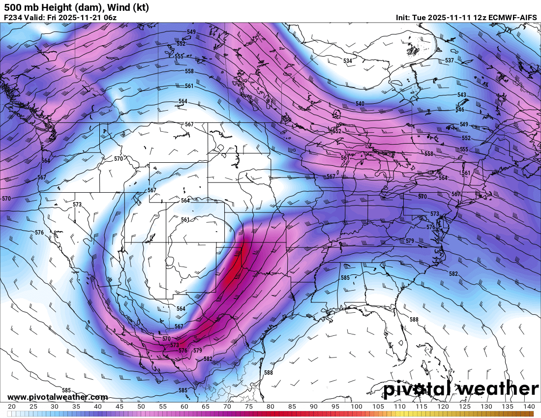
And that system won’t be the only one; as we move through next week, there are some strong indications that a much stronger storm system could approach by next weekend, with severe and winter weather likely.
What Can We Expect?
For now, I really think it’s prudent to focus in on the first system that’ll be here in about a week, as the second system remains pretty unresolved in terms of details.
Before I get to that, if you want a more detailed and video-based version of this forecast, be sure to check out our newest video on YouTube for our channel members that also includes a look at what models are saying for next Spring’s tornado season. For just $2/month you get exclusive access to some of our video content and you support our educational and informational mission here at Tornado Titans. Please consider joining!
As we move into next week, the big trend I’m seeing on models is for a good batch of precipitation to the west of the mountains in CO/NM, followed by another area of abundant precipitation further east, with a large dry hole in the middle. This is bad news for places like Amarillo but may mean places like Tulsa get in on the action.
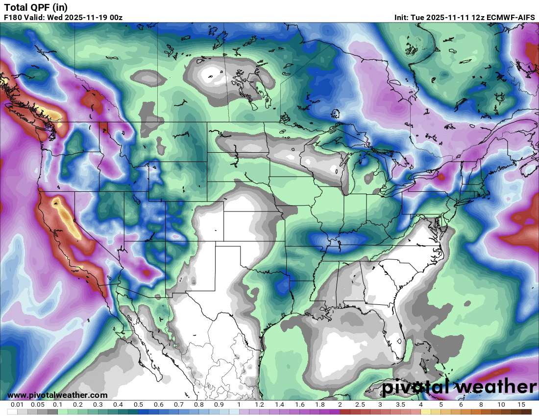
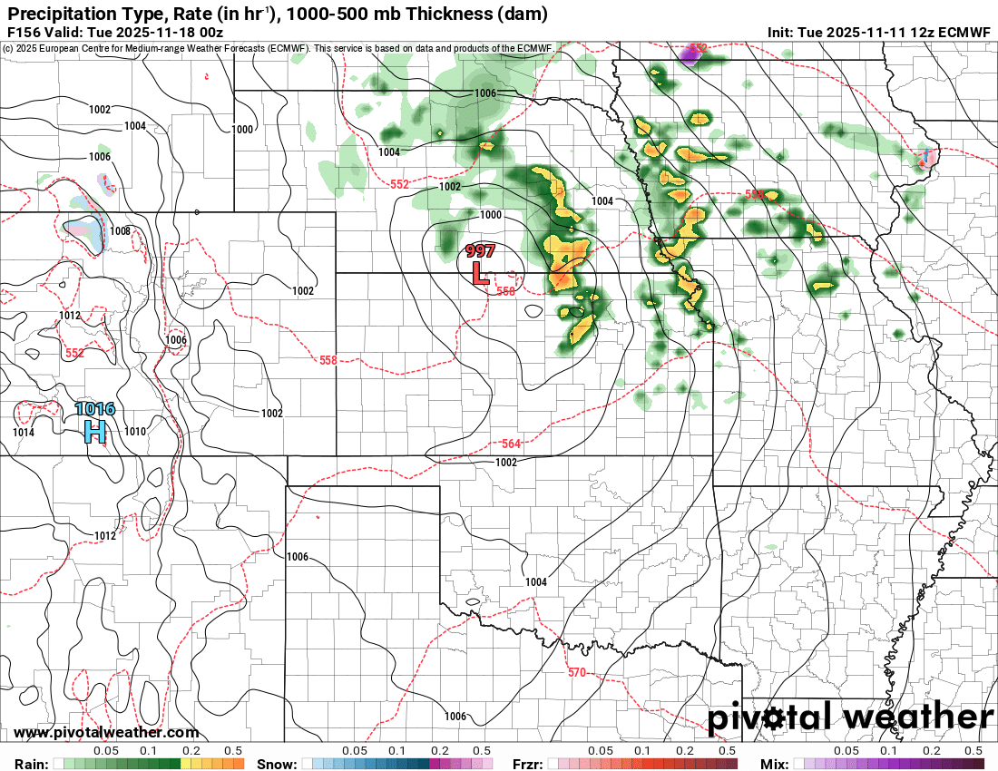
A closer look at timing shows Sunday night-Monday morning will see the system emerging with snow in the higher elevations out west and rain in the valleys:
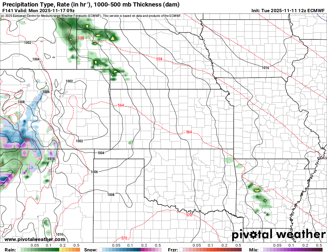
By Monday afternoon, the low will have moved east over the Plains, with moisture drawing up from the Gulf, setting the stage for some severe weather, possibly from northern Kansas down into Texas. The consensus right now is that it will generally be from I-35 and east.
Given that this is over a week out, I’m lamenting getting that granular at this point, as a slight slowdown or acceleration in the system would make for some pretty meaningful differences in storms in Oklahoma City or Dallas, or being behind the dryline with gusty winds and clear skies.
Still, I think it’s pretty apparent that there will be at least a severe weather chance early next week as the system moves east — how far south from the low storms can form will depend on many factors; I’m seeing mixed signals, though. Some models like the GFS are pretty bearish on storms forming at all, while the Euro has a pretty robust environment from Kansas to Texas that’s primed for severe storms. We’ll be watching and updating on this across our social media profiles.
Monster Glowing Storm
Seeing a storm so thick and dense that it transforms what should be a beautiful afternoon into night is always a surreal experience, and it usually requires a pretty wet atmosphere to make it happen.
See this chase story on our YouTube channel now!