


🌪️⛈️ High Plains Set For An Active Week
Storm season never ends, it just moves.

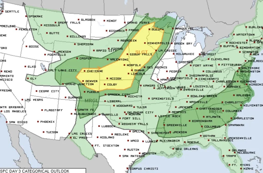
Oftentimes as we move into July, storm season continues to crank across the Central and even Southern High Plains. This is especially true in years with some sort of an El Niño pattern ongoing.
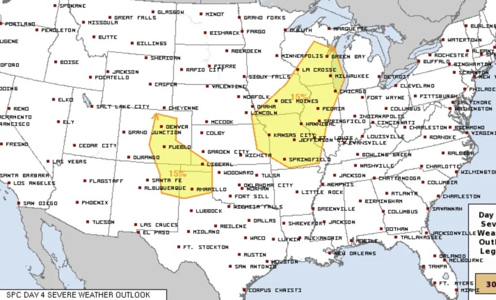
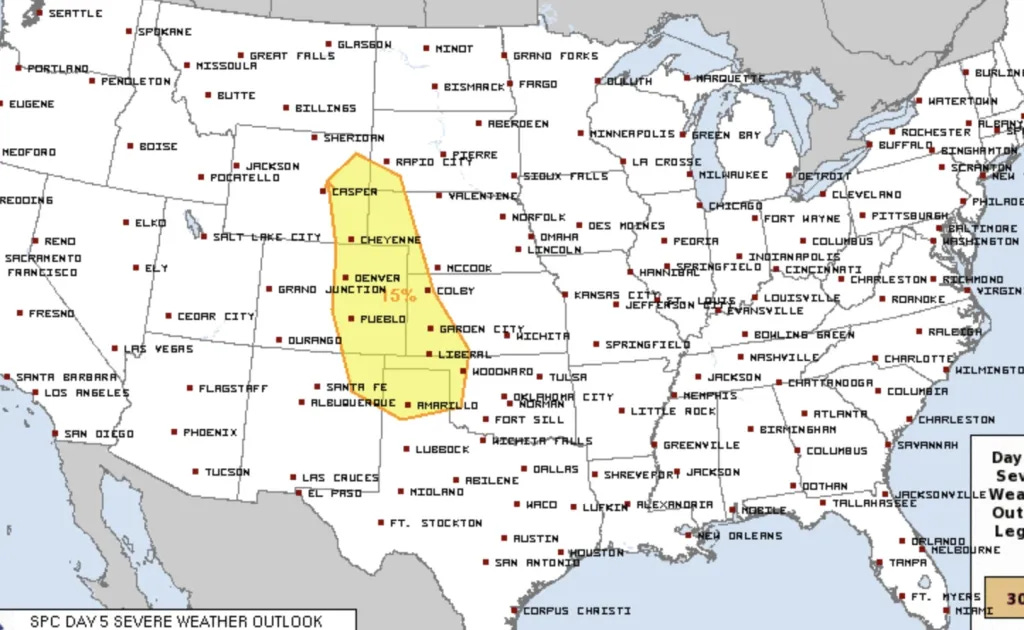
And 2023 will be no different at least for this week. It looks like we may have daily rounds of storms off of the Rockies starting on Tuesday or Wednesday with supercells and tornadoes possible each day.
There’s a lot to like about this week:
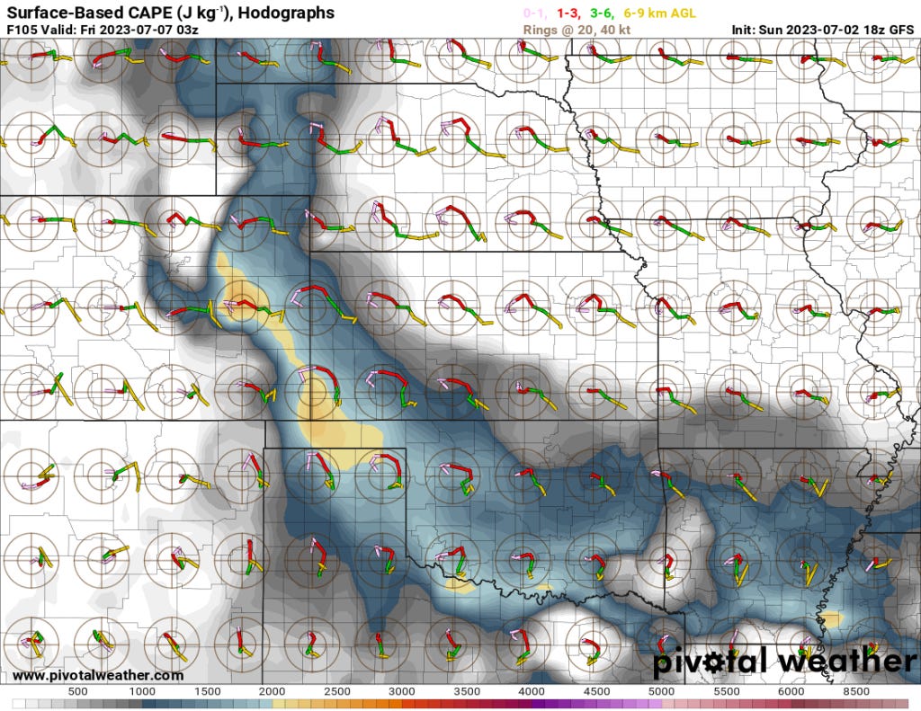
Mid-level jet stream winds will move over a ridge situated across the Southwest U.S. These winds will be more than strong enough to organize storms into supercells.
At the surface, dewpoints in the high 50s to mid 60s will exist across the Central and Southern High Plains. These are the dewpoints you need for the memorable supercell and tornado events in this region.
The overall parameter space each day moves around and varies, but every single day features conditions I would describe as pretty favorable for severe weather, supercells, and tornadoes.


The Bottom Line
It’s going to be a pretty busy week. Models are pretty consistent with a solid batch of mid-level flow much of the week with good moisture in place. During the summer months, that usually means severe weather for NE New Mexico up through Eastern Wyoming.
We’ll likely be out and about. Storm season never ends.
Have fun and stay safe if you’re out!