


⚠️ First Severe Weather Threat of 2023 🌪️⛈️
Eastern portions of the Southern Plains into the Arklatex are under the gun today.

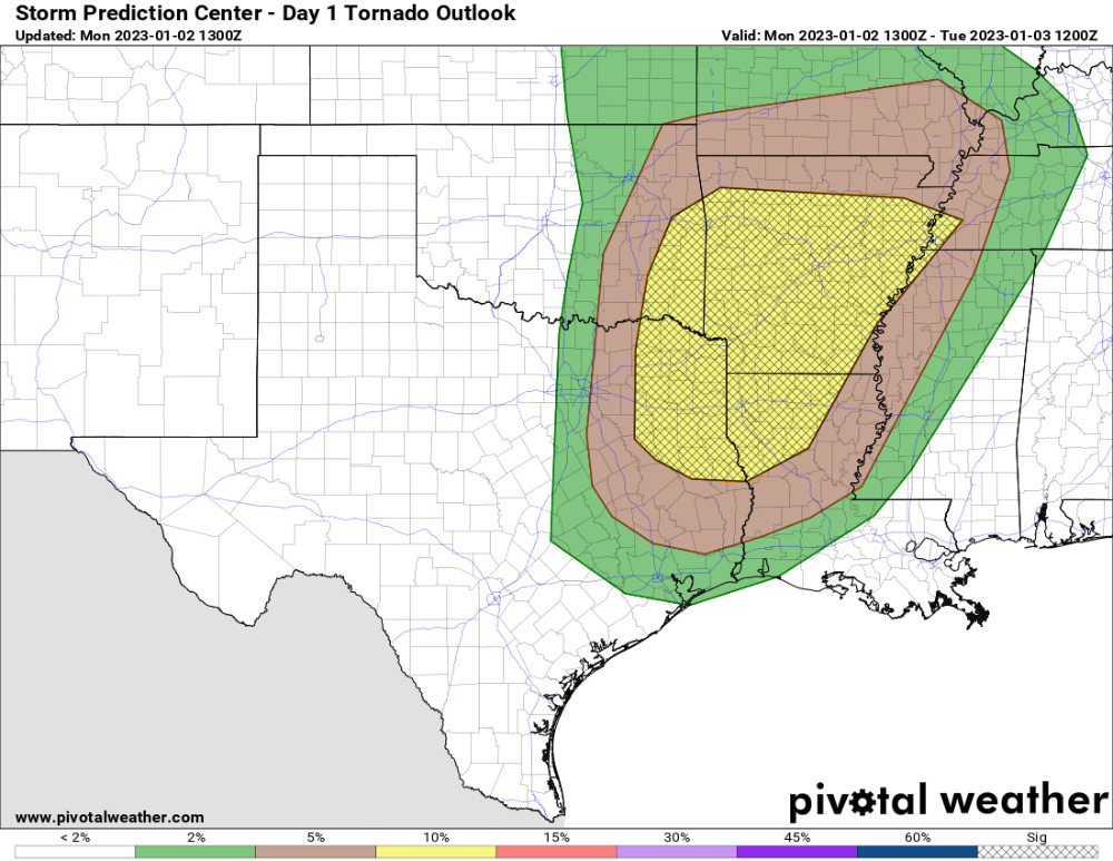
The first severe weather risk in the middle of the country for 2023 waited a full day to appear: it looks like we’re in for an enhanced threat of a few tornadoes in the region starting this afternoon and lasting into tonight. Additionally, damaging winds and some hail will be possible as well.
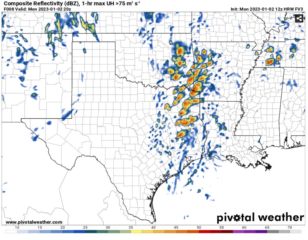
Messy Storm Modes: The big takeaway I have from this morning’s model runs is that the storm modes look pretty messy/crowded throughout the day. Storms initially form in the mid-afternoon and expand in coverage and increase in intensity into the evening/night.
There is enough wind shear present for a few of these storms that can keep clean inflow layers to rotate. More crowded storm modes will limit this threat.
The tornado risk likely maximizes near and after dark, but it will be on the rise starting by about mid-afternoon.
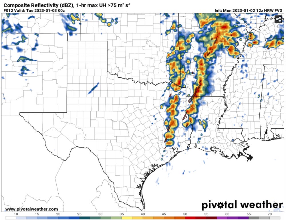
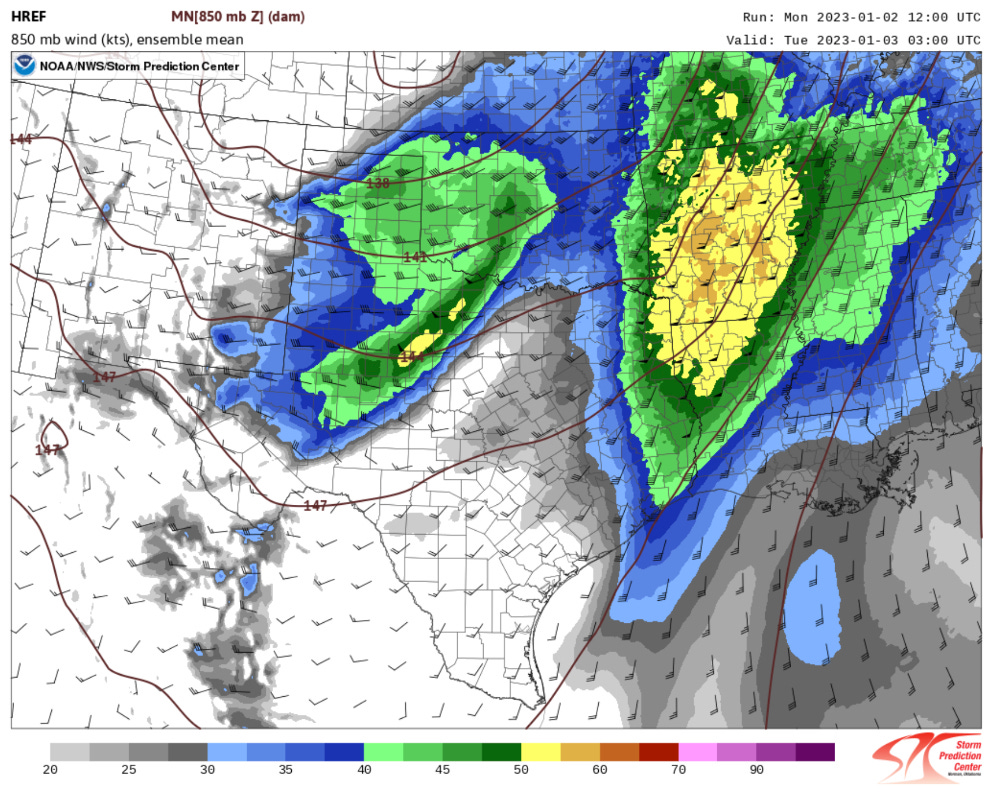
There will be two waves of storms. An early wave that forms over NE TX/SE OK which races northeast and then another that forms further west towards dark along a pacific front perhaps all the way back to I-35.
The day starts with a pretty robust cap: Morning soundings showed strong capping over the region thanks to a pronounced EML that moved overhead the past day or so. This will likely delay storm formation further west until dark or just after as the main upper energy brushes past.
Storms further east will likely form in a zone of weak general lift this afternoon, but due to the cap they may not be fully based at the surface at first. This would initially limit tornado chances if that occurs.
The environment is a pretty typical cool season low cape/moderately high wind shear type of environment. Any isolated storms rooted at the surface will be dangerous to be sure.
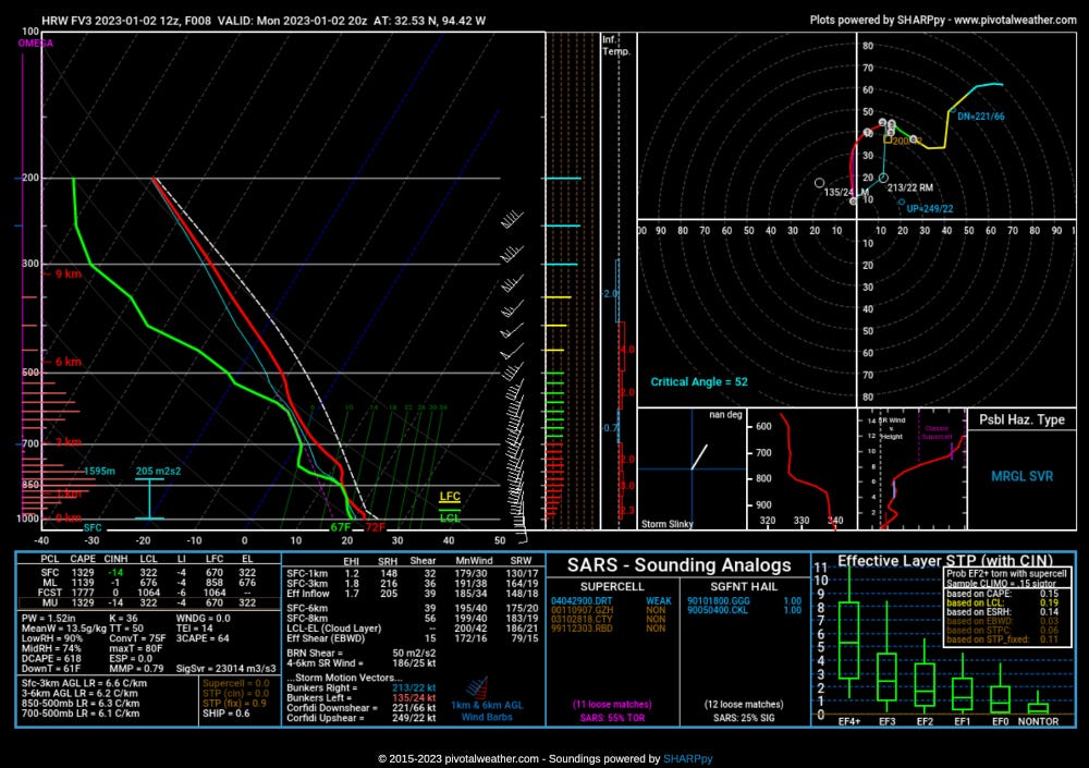
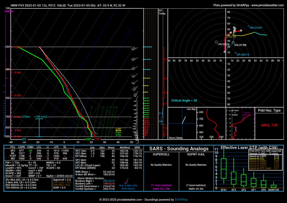
The things to watch: I feel like a broken record, but many to most severe events come down to storm mode — this is especially true for events in the cool season. The length of time that storms are isolated/surface based will determine how large the strong tornado threat ends up being.
Given the strong low-level jet, linear storm structures will be capable of the quick spin-up tornadoes well after dark no matter how things evolve throughout the day.
The cap and how quickly it erodes will likely determine how large the tornado threat is before dark with the initial wave of storms. If you can get enough heating/destabilization in the low-levels by mid-afternoon, a few tornadoes seem like a reasonable bet across the enhanced threat area.
How far west will storms go? Some models have cells firing up as far west as I-35. Even back that far, storms will have a tendency to rotate if they are isolated, so we’ll have to watch for tornado potential that far west into the early evening.
The bottom line: Expect the tornado risk to be at its highest from about 4 p.m. to 8 p.m. today in the enhanced threat area outlined above. Tornado watches seem likely to go out by early-mid afternoon.
Have a source of weather info close by.
Be sure to share forecasts with your social networks, awareness of incoming severe weather threats is a major help towards determining if people can take adequate shelter or not.