


😅 Busy Severe Weather Day Expected
Texas will see giant hail and possibly tornadoes today.

Don’t let anyone tell you otherwise, days like today are the hardest to forecast because there is already so much ongoing that you really don’t even have a clear picture of what things will look like in four hours, much less eight.
With that said, there’s officially an enhanced threat of severe storms today in North and Central Texas, including for tornadoes — but I think the tornado risk is a highly uncertain risk.
What *Probably* Happens
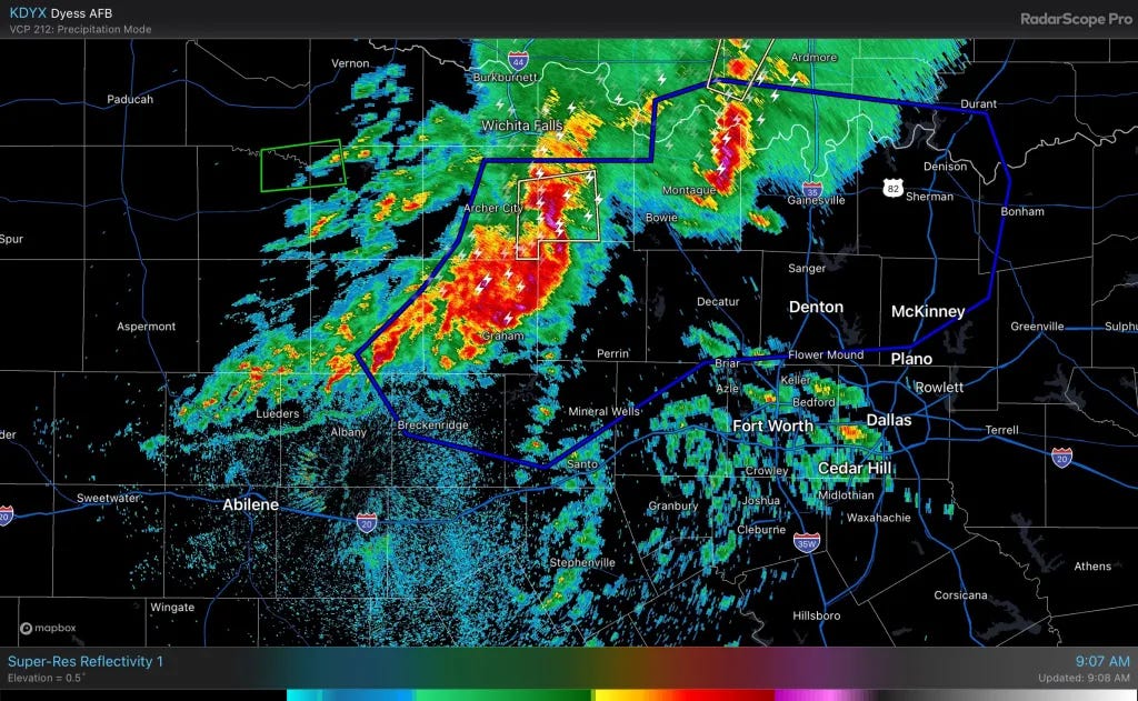
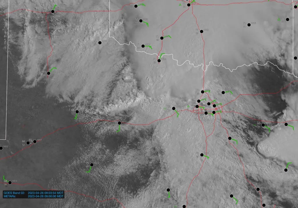
As cold outflow surges south on the tail end of soon to be severe storms in North Texas, I think the target area today gets compressed in time and space pretty fast. I suspect that storms will backbuild along the outflow boundary through the afternoon, with a couple of supercells forming in a crowded fashion just south of it. Those storms would be the ones to watch for tornadoes this afternoon and evening.


Severe Weather is Certain
Let me be clear, especially for all of our peeps in the DFW area — there is going to be severe weather today. There will be giant hail. There will be damaging winds. Irregardless of the tornado threat, severe weather will happen and be plentiful today.
The threat will begin to maximize after 2 p.m. or so local time, but severe weather is possible even as you read this.
Tornado Threat Will Be Conditional
Today is a day that, if it were literally a few hours closer I probably would’ve bit on for a storm chase. I think today is a day either where you get a storm that goes absolutely bananas, producing tornado after tornado — or it is a day where few/no tornadoes happen due to storm crowding and progressive outflow.

The Bottom Line
Expect severe weather basically all day today starting in North Texas and extending south and east from there. I also think there could be some isolated severe storms further north and west too — but those will be capable of marginally severe hail only.
Beyond today, Friday may feature enough moisture ahead of a crashing front for a few severe storms. Otherwise, it looks like a see you next week type of situation!