


And Quickly, Now Comes Summer
The summer ridge will begin to build in this week.

As promised, the pattern was busy the last couple of days of May into this first week of June. We should see a few more days of busy severe weather action this week before the annual summertime ridge of high pressure builds in, signaling the end of the Spring storm season.

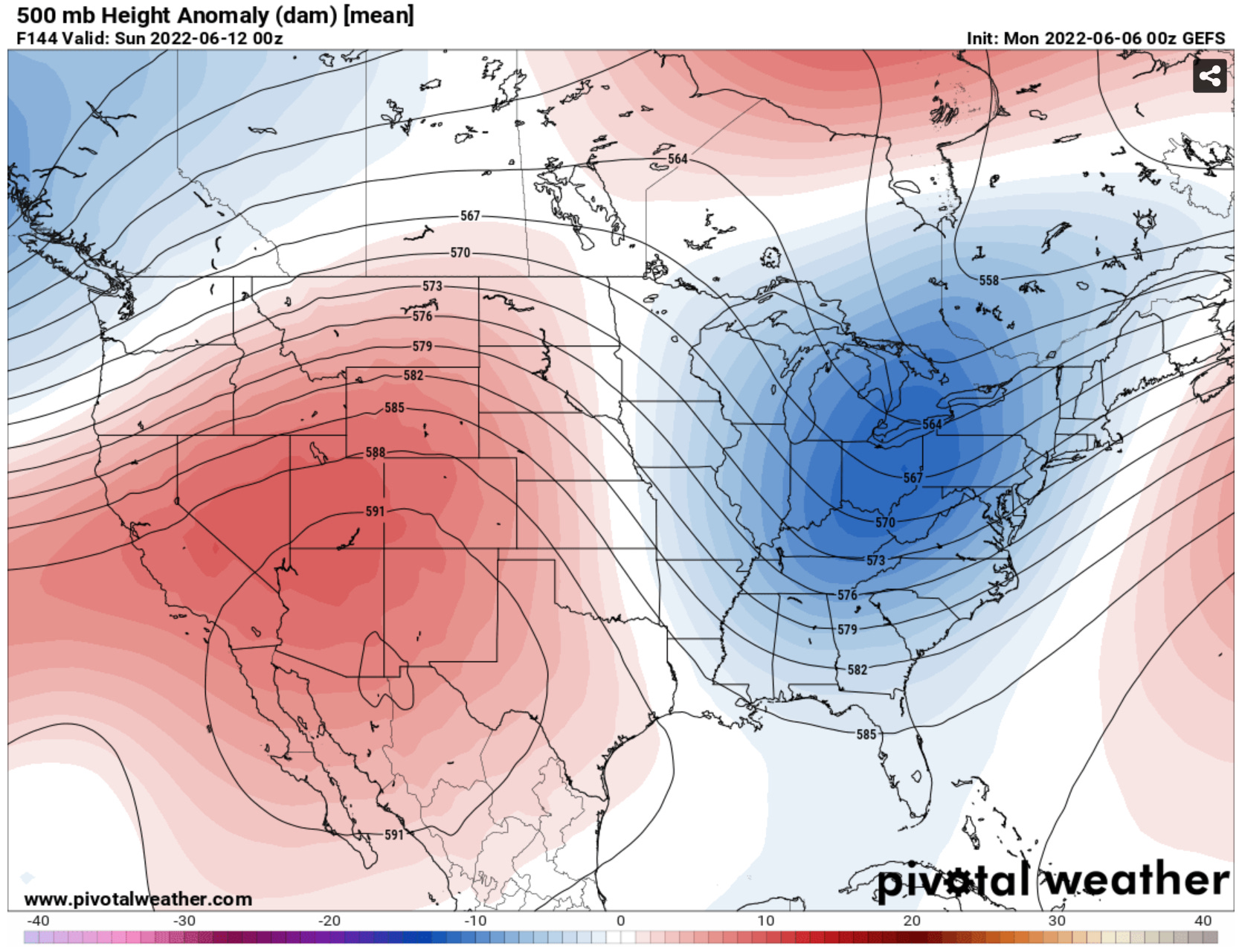
Whenever a strong ridge like this builds in, usually sometime from late May to mid June, that is the signal that our spring severe weather season is coming to an end on the central and southern Plains. Thereafter the threats shift to the northern Plains, Midwest, and Northeast as the jet stream migrates northwards.

The ridge will fluctuate some throughout the summer of course, bringing with it sporadic chances of severe weather on the Plains — but the regular expectation of supercells south of I-70 or even I-80 is basically over for the year as of this weekend.
The axis of severe weather threats will reside mainly north of I-80, or across the northern Plains through much of the summer as it usually does. Hardcore storm chasers will certainly still have chances to cash in, but even those tend to be more sporadic and costly, especially with gas nearing $5/gallon!
This Week
Expect a continuation of the pattern we’ve seen much of the last week, with supercells (mostly high based) forming off of the dryline and upslope flow and consolidating into lines and clusters as they move southeast. Sporadic tornado chances will continue to accompany this activity, but the main threats will remain damaging winds and big hail.
As always, be sure to follow us on social media platforms, our favorites are Facebook, Instagram, and TikTok, for our very latest updates!
Sad to see the storm season near it's end.